Project Rationale:
Critical streets in terms of network performance and connectivity were determined in the city of Isfahan.
Description:
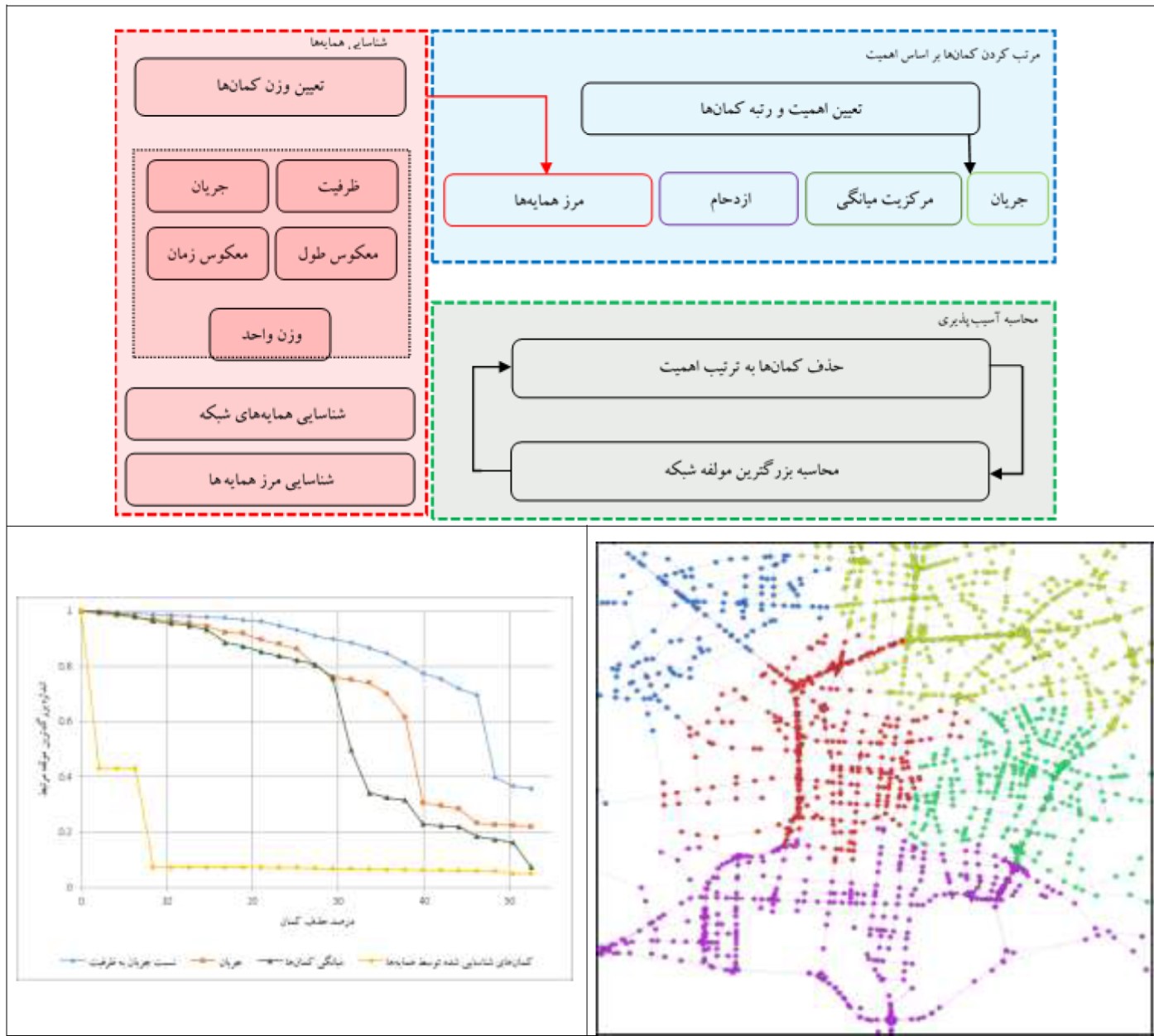
- In this research, vulnerable spots and areas of the network were identified using cluster detection analysis methods. Moreover, the info-map method along with the centrality metrics were applied on the network arcs to determine the vulnerable areas. In this technique, first, the urban road network is abstracted in the form of a graph, and then the clusters are determined on the basis of dynamic equations and the traffic flow pattern passing through the road network.
Road capacity, traffic volume, inverse of the road length, and inverse of the travel time were considered as the weight of the network arcs, and their corresponding neighbors were determined using the info-map method. In addition, buffers between neighbors as well as the arcs with high centrality level were identified as vulnerable spots of the Isfahan urban road network. Considering these vulnerable spots and areas assists planners to set such locations as the first priority for implementing new construction and road development policies.
Results showed that, vulnerable parts of the network were: the corridor crossing Zayande Rood, the southern boundary of Shahid Raddani Pour highway, the eastern boundary of Shahid Kharazi highway, the southern boundary of Atashgah street, the eastern boundary of Shahid Sayade Shirazi highway, the southern boundary of Kaveh highway, and streets in the city center such as: Seyyed Alikhan, Nikbakht, and a part of Chaharbagh Pa'in streets.